


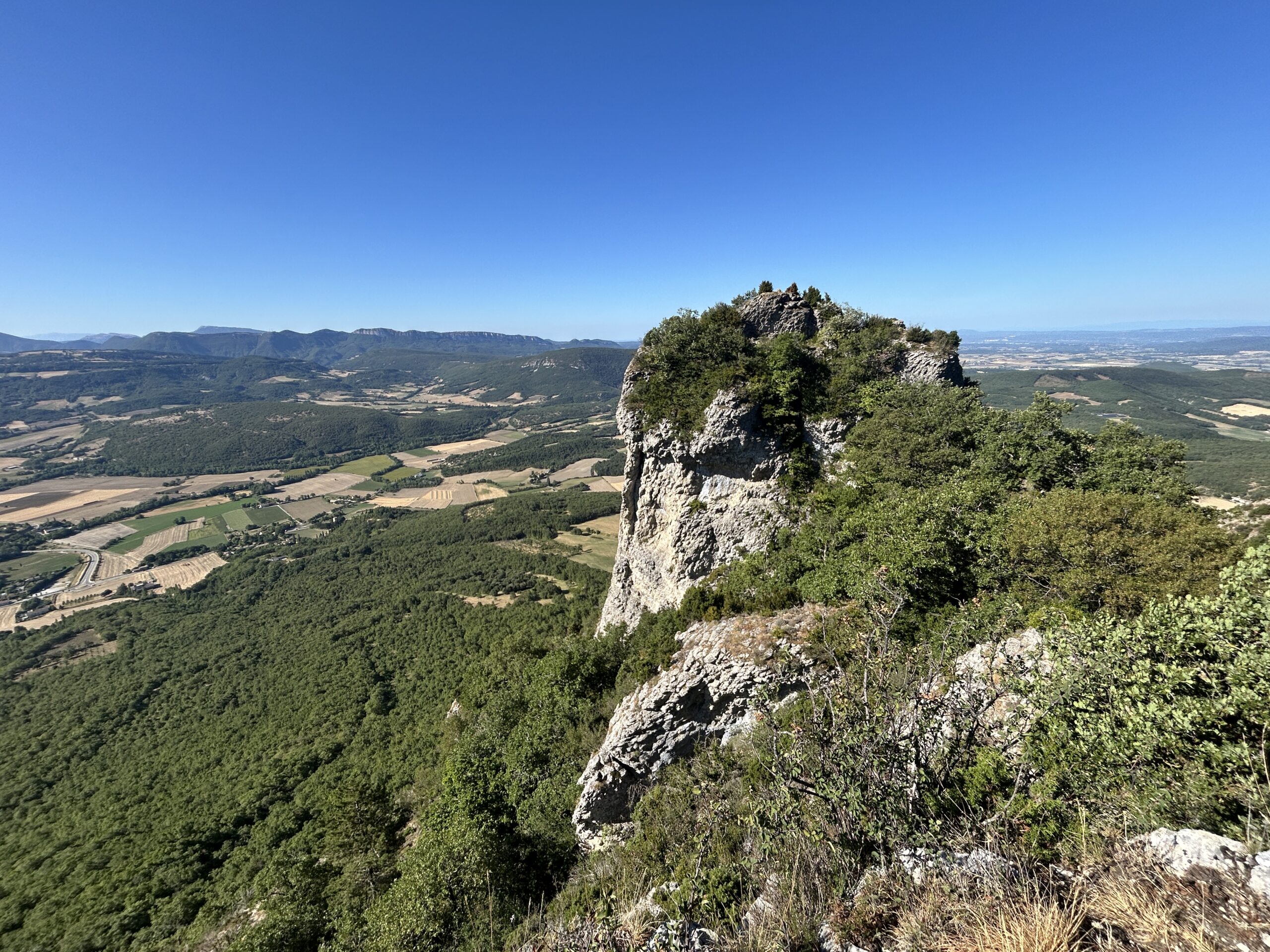
It was the sixth day since we arrived at Le Poët-Laval in the Drôme Provençale. It was also the last free morning we could do a trail run before returning to Grenoble. We picked a short trail in the Saoû forest, 24 km northeast of our gîte. It was about the same distance as the trail run we did five days ago, but with more elevation gain. It would be a loop of 9.5 km with 600 m elevation gain, starting at Saoû village at 340 m and reaching an altitude of 886 m.
Hoping to avoid the worst of the heatwave, we set out early. After a 30-minute drive, we reached the Saoû public parking lot slightly before 9 a.m. We targeted finishing by 11 a.m., with a chance to do the run under 30°C.
The climb hit us immediately. The first few hundred metres were on the asphalt, then followed by gravel. By the first kilometre point, we had already covered 160 m (16% gradient). I tried alternating jogging and fast walking but surrendered the jogging after just a few minutes. A steady fast hike seemed more sensible in light of the steepness, despite the multiple road bends.
Other than the steepness of the ascent, it was a pleasant hike in the Saoû forest. The trail was shaded by oak trees and the morning air was cooled by the occasional breeze. The heat was not as unbearable as we had imagined it would be in the current heatwave. We had the whole trail to ourselves up to the first lookout point after 2 km of hike. The first sight of anyone was at the first lookout point at 780 m. It was a couple who left immediately after we reached there.
It took us 44 minutes to climb 440 m over 2 km. We paused for a few minutes to take in the panoramic view. It was surprisingly windy and I had to hold on to my cap. The refreshing respite made us forget that we were currently experiencing a heatwave in France.
From the first lookout, we still had another 1 km and 100 m of elevation to reach our highest point for today: rocky peak at Roche Colombe, sitting at 886 m high A 22-minute climb got us finally to the top. Timing worked in our favor once again as two groups of hikers were about to leave when we arrived.
We took a longer break this time round to refuel ourselves with some leftover nougat that I had brought along. I didn’t really think that we needed the food as it was supposed to be a shortish run. I brought it along for a “just-in-case” scenario that the heat struck us harder than expected. Even though the heat wasn’t as bad as we thought, the technical nature of the steep, rocky climb took a bit of energy out of us. In the end, the nougat gave us the sugar boost that we needed.
It was all descent from this point: 6.5 km. The descent was mainly on trails for 4.5 km, and then followed by 2.0 km on asphalt to the parking lot. We spotted hikers as we descended, but not more than a handful. The orange weather alert for the Drôme department had likely kept the holiday-makers away. The 4.5 km descent was a mixture of short, steep rocky descents and nice runnable forest trails. One of the well-known steep descents was the Pas d’Échelette. A safety cable and some metallic steps were provided to help with the vertical descent of about 3 to 4 metres. I would definitely avoid this passage on a rainy day.
The asphalt descent was tough on the quadriceps, with a negative gradient between 10% to 15% for 1.5 km before it flattened out for the remaining 500 m to the parking lot. We arrived at 11:20 am, 20 minutes later than planned. Regardless, the temperature was still pleasant with gusts of wind. I was glad that we stuck to our plan to get out of the gîte and braved the heatwave. I like to start my day with a workout; a morning workout always improves my mood and augurs a fruitful day ahead.
After freshening up with a change of shirts and devouring the ripe, juicy nectarines that were left in the car, we walked to the village centre for some cold drinks. By serendipity, we came across Cérise et Vinaigrette, a restaurant terrace for outdoor dining. The menu was simple and the food was ‘top’, as the French would say. I loved my plate of squids (chipirons) sautéed in creamy garlic butter, accompanied by a generous portion of velvety mashed potatoes. The dish was decorated with three pieces of very spicy chorizos and 2 slices of crunchy lettuce (I ate all my greens!) . The meal was definitely the best out of the three dining experiences we have had so far this week in Drôme Provençale.